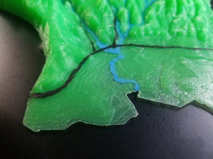
Whole SLV watershed printed!
I 3D mapped the San Lorenzo watershed using topographic maps with lines every 50 feet of elevation. Then I rendered it into a 3D mesh on Blender. I printed the 12×5 inch watershed using green PLA and I painted river detail and highways 1, 17, and 9. The painting of the roads is just estimated.